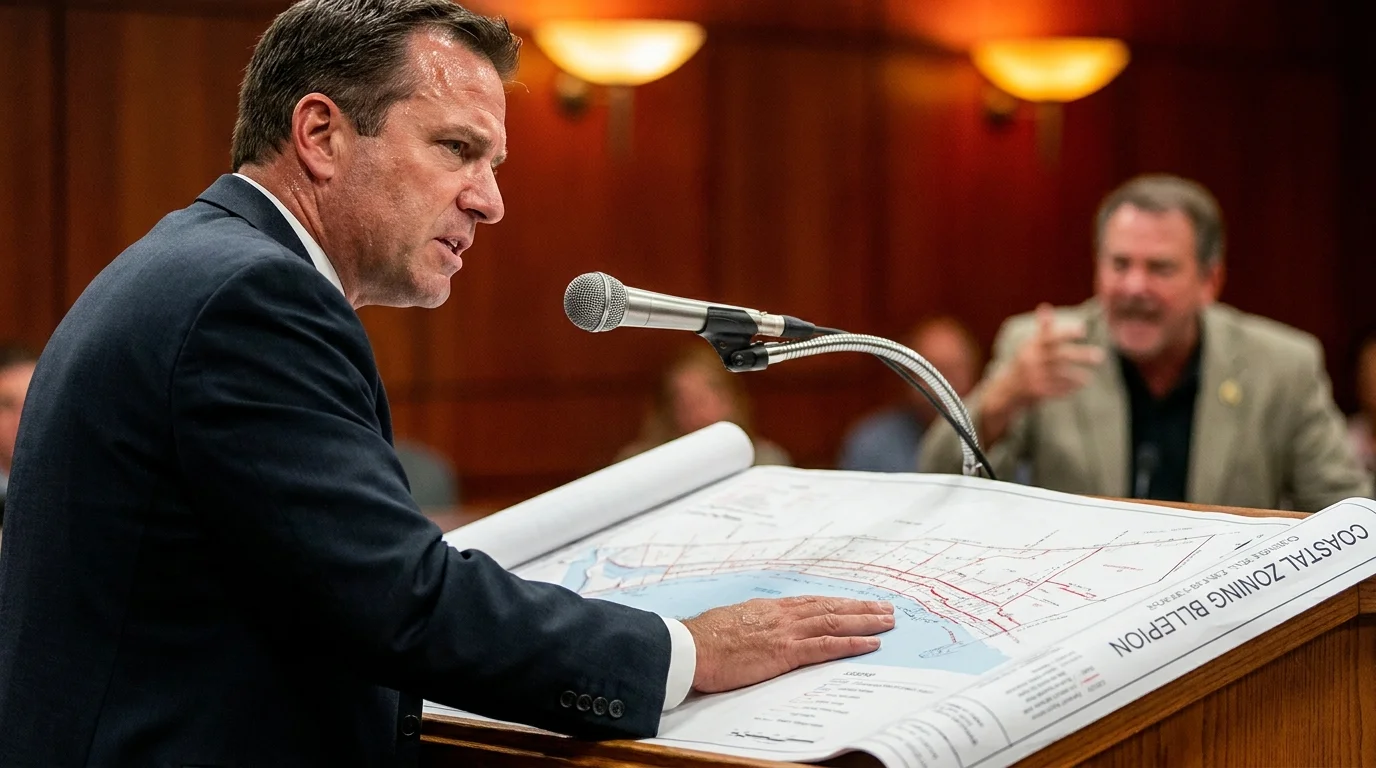
The tide moves out along the salt marsh, leaving behind the sharp, mineral tang of wet cordgrass and low water. From your back deck, the horizon looks permanent, measured by the rhythmic slap of brackish water against timber pilings and the cries of gulls cutting through the morning fog. You hold an architect’s blueprint curled in your hand, its edges soft from weeks of thumbing through dimensions for a modest kitchen expansion and a reinforced seawall.
Everything felt settled. You sat through two municipal public hearings in a drafty community center, watching your elected town council vote five to one to approve your building permits. The local building inspector stamped your plans, your contractor scheduled the excavator, and you wrote the deposit checks. In a functional town hall system, this is where the dust begins to fly and the framing goes up.
Then a registered letter arrives on heavy cardstock from a body you never voted for and whose meeting schedule was never printed on a ballot. The notification informs you that your parcel falls within a newly drawn, non-negotiable hundred-foot buffer zone. Your residential permits are voided before a single shovel enters the loam, not by your alderman or council member, but by a quiet stroke of an unelected coastal panel’s pen.
This is the consensus inversion play in real time. Across the American coastline, regional conservation and resource panels are turning administrative advisory status into absolute veto authority. By exploiting statutory carve-outs written into state wetland frameworks decades ago, these boards bypass public municipal debate entirely, stranding private homeowners in legal limbo.
The Invisible Shoreline: How Advisory Logic Became Sovereign Law
To grasp what happened to your project, you have to look past the town council dais and peer into the administrative machinery humming beneath it. Most property owners believe zoning power flows through a clean, vertical pipeline: town meetings debate rules, elected councils pass ordinances, and municipal building departments enforce them. It feels transparent, accountable, and subject to the ballot box every two years.
Yet coastal setback boards operate on a very different legal plane. Decades ago, states established regional environmental advisory panels to provide scientific assessments on tidal surges, dune degradation, and marsh retreat. Over time, state legislatures quietly updated enabling legislation, transforming these boards from advisory consultants into mandatory gatekeepers. Administrative statutes now supersede municipal authority, meaning your town council can vote unanimously to grant a variance, but that approval is legally meaningless without a regional sign-off.
Think of it as breathing through a pillow. The local political process still takes in air, debates issues, and holds hearings, but the actual flow of authority is muffled and restricted downstream. These panels do not host broad public referendums or listen to emotional pleas during three-minute public comment slots. They evaluate rigid hydrological maps in closed technical review sessions, drafting arbitrary boundary markers that pull construction lines dozens of feet inland overnight.
- Minnesota payroll deductions quietly drain middle-class paychecks before bank deposits clear
- Tucker Carlson interviews split primetime feeds into conflicting foreign policy realities
- DuPage County rezonings spark furious suburban rebellion against traditional party slates
- Fair Admissions rulings freeze minority municipal contracting programs across major cities
- Citigroup firearm policies spark state contract bans across Texas municipal finance
What appears on paper as a mundane environmental update is actually a massive shift in real estate equity. When an unelected panel extends a setback boundary by forty feet, it effectively confiscates usable land without paying compensation. You still pay property taxes based on your full parcel size, but the buildable footprint shrinks to a fraction of its original dimension, all without a single public debate.
The Secret Map in Room 204
Consider the quiet ordeal of Dan Callahan, a 54-year-old boatwright who spent seven years restoring a saltbox cottage on coastal marshland in Glynn County, Georgia. Dan had lived alongside the tides his entire life; he knew precisely how the seasonal high-water line crept toward his foundation each October. When the town council approved his application to rebuild a decaying screened porch and elevate his home above the newly calculated FEMA base flood elevation, he believed his family was finally secure.
Three weeks later, an regional resource oversight panel stepped in during an unpublicized Thursday morning session. Citing a newly adopted predictive marsh migration algorithm, the panel redrew Dan’s parcel boundary, shifting the setback inland by sixty-five feet. His renovation was halted indefinitely with no formal mechanism for administrative appeal outside of filing an expensive complaint in state superior court. The council members he helped elect could only shrug; state statute explicitly shielded the advisory panel from municipal oversight.
Mapping the Squeeze: How Different Waterfronts Are Impacted
Not every waterfront parcel faces the exact same regulatory squeeze. The tactics used by these setback boards vary depending on how local geology meets state statutory definitions. Understanding which category your property falls into is the first step toward figuring out your options.
The High-Bluff Homeowner: Along elevated coastal ridges, setback boards rely heavily on predictive erosion curves. Even if your cliff edge has moved less than an inch over fifty years, panels use computerized modeling to project catastrophic seventy-year collapse scenarios. They impose massive mandatory setbacks from the bluff crest, banning not just home additions, but also patios, retaining walls, and detached workshops.
The Tidal Marsh Borderer: If your yard brushes up against cordgrass or black needlerush, boards rarely look at your actual dry ground. Instead, they apply wetland expansion buffers designed to accommodate future sea-level rise decades from now. Your usable yard disappears under speculative future-water projections, preventing you from replacing rotting bulkheads or expanding your home footprint outward.
The Infill Lot Owner: If you own a vacant or underbuilt lot between two existing homes, you face the sharpest dilemma. The neighbors on either side may have large structures built under previous rules, but the newly imposed setback lines make your parcel legally unbuildable. The panel effectively freezes your property value, turning a prime residential lot into an unmarketable private park for the neighborhood.
Mindful Resistance: Navigating the Boardroom Gauntlet
Dealing with an unelected setback panel requires abandoning emotional arguments. Pleading hardship or showing community support will not sway civil servants whose sole mandate is defensive statutory compliance. You must match their bureaucratic rigor with precise, physical data.
Take these measured steps before signing contracts or contesting an administrative freeze on your home:
- Audit the Jurisdictional Baseline: Commission an independent, stamped elevation survey that measures mean high water marks using real-world physical benchmarks rather than satellite elevation models.
- File a Targeted Open Records Request: Request all intra-agency correspondence, GIS shapefiles, and hydrological working notes regarding your specific watershed zone. Board administrators often rely on draft models that were never formally adopted.
- Document Historical Shoreline Hardening: Compile historical aerial photography, soil core samples, and permitting records proving long-term shoreline stability to rebut speculative computer modeling.
- Secure Joint Council Support: Request an official letter of contest from your municipal attorney arguing that the panel’s action infringes on home-rule land-use powers.
Assemble a lean tactical toolkit to challenge these decisions: an independent coastal engineer, an administrative land-use attorney familiar with your state’s Administrative Procedure Act, and a detailed historic shoreline map verified by an independent surveyor.
The True Value of Ground You Can Stand On
Owning a home near the water has always involved a quiet negotiation with natural forces. Waves erode, tides fluctuate, and winds test the integrity of cedar shingles and treated fasteners. That natural rhythm is honest and predictable; it is part of the contract you sign when you choose to live near the water.
The administrative tide is far more challenging. When nameless panels use technical jargon and closed doors to overturn decisions made by your elected neighbors, it chips away at your sense of stability. Reclaiming agency over your land begins with understanding that administrative decisions are not natural laws. They are bureaucratic constructs, and like any paperwork built on contested data, they can be questioned, dissected, and pushed back.
Waterfront property rights do not end at the tide line; they end where unelected administrative overreach goes unchallenged by the local community.
| Key Point | Detail | Added Value for the Reader |
|---|---|---|
| Jurisdictional Drift | Advisory environmental panels converting discretionary reviews into binding setback lines. | Explains why municipal building permits get overturned after council approval. |
| Algorithmic Mapping | Using unverified predictive sea-rise models instead of physical on-site surveys. | Identifies weak points in agency evidence that your land-use attorney can challenge. |
| Administrative Remedy | Appealing decisions through state APA filings rather than standard municipal variance boards. | Saves months of wasted effort pleading cases before powerless city councils. |
Frequently Asked Questions
Can a coastal setback board really overrule an elected city council?
Yes. In most coastal states, enabling legislation gives state resource panels preemptive statutory authority over coastal environmental zones, rendering local council approvals subordinate to their review.Why didn’t I receive notice about these boundary changes?
Advisory boards frequently operate under administrative notice rules, which typically require publication in county legal registers or state agency websites rather than direct mail to affected property owners.Can I sue the board for an unconstitutional regulatory taking?
Regulatory taking claims are difficult to win unless you can demonstrate the setback eliminates all economically viable use of your entire parcel, not just your proposed renovation footprint.How much does it cost to fight an administrative building freeze?
A formal administrative appeal involving specialized coastal engineering reports and dedicated land-use counsel typically ranges from $15,000 to $45,000, depending on the complexity of your site.What is the quickest way to get an exemption for basic repairs?
Focus strictly on in-kind repair clauses within the existing footprint; boards often maintain administrative maintenance exemptions that allow structural stabilization without triggering modern setback reviews.